Friday, 4 September 2015

Two Sisters 2015

Made a trip to Two Sisters Mountain(s) on September 2nd.  Was an interesting journey.  I have been up the mountain before but took another route to get there and in all honesty I didn't know the route we took the first time there.  I studied a few maps and programmed some way points into my vehicles GPS, some of which were in the middle of no where as the roads did not exist on the Garmin GPS, yet they did on google maps.  Some turns i made i was hoping for the best!
I aired my tires down to 16 PSI at Buckhorn lake.  Hoped this would be a good happy medium between fuel economy and comfort as it was going to be a bumpy drive.  Also had hoped not to have to drive into Wells for fuel if i could help it.  I did bring a jerry can just in case.

I fumbled around with the map a little but found my way to the West side of the Willow River, catching glimpses of it though the trees every now and then and i knew i was on the right path.  More so when i came to a wash out that was familiar from my last trip.  It had gotten a little meaner since the last time I was there.  I didn't get very many good pictures here, specially of the tough part.  I had to put my passenger tire on the dam to avoid a deep hole on my side, was a little nerve racking as it was holding back a fare amount of water.


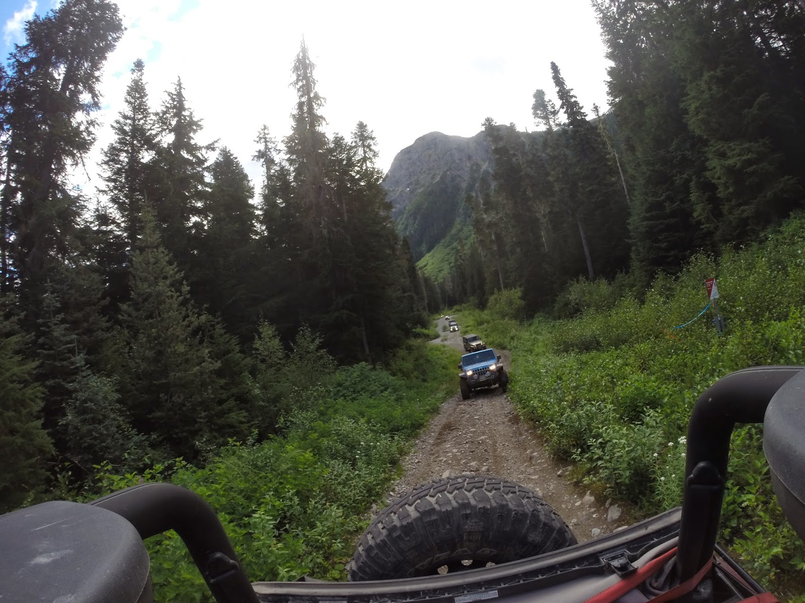
The trail was well worn up to the washout, soon as i got across I could tell that many turned around there as I was met by a few fallen trees, then it seemed to be a bit of a theme.  On this section of the trail I had to remove maybe 8 trees in total and drove over more than a few that were down flush to the ground.  A few were stubborn to get passed with my hand saw and axe.  

Another interesting part of the trail i came across was this overflow area.  It looked more intimidating than it was.  The back side of the dam (water side) was sloped nicely in my favor.  Four low and lockers engaged just in case but i think i probably could have done it in 2 wheel drive.


Looking back after I'd crossed

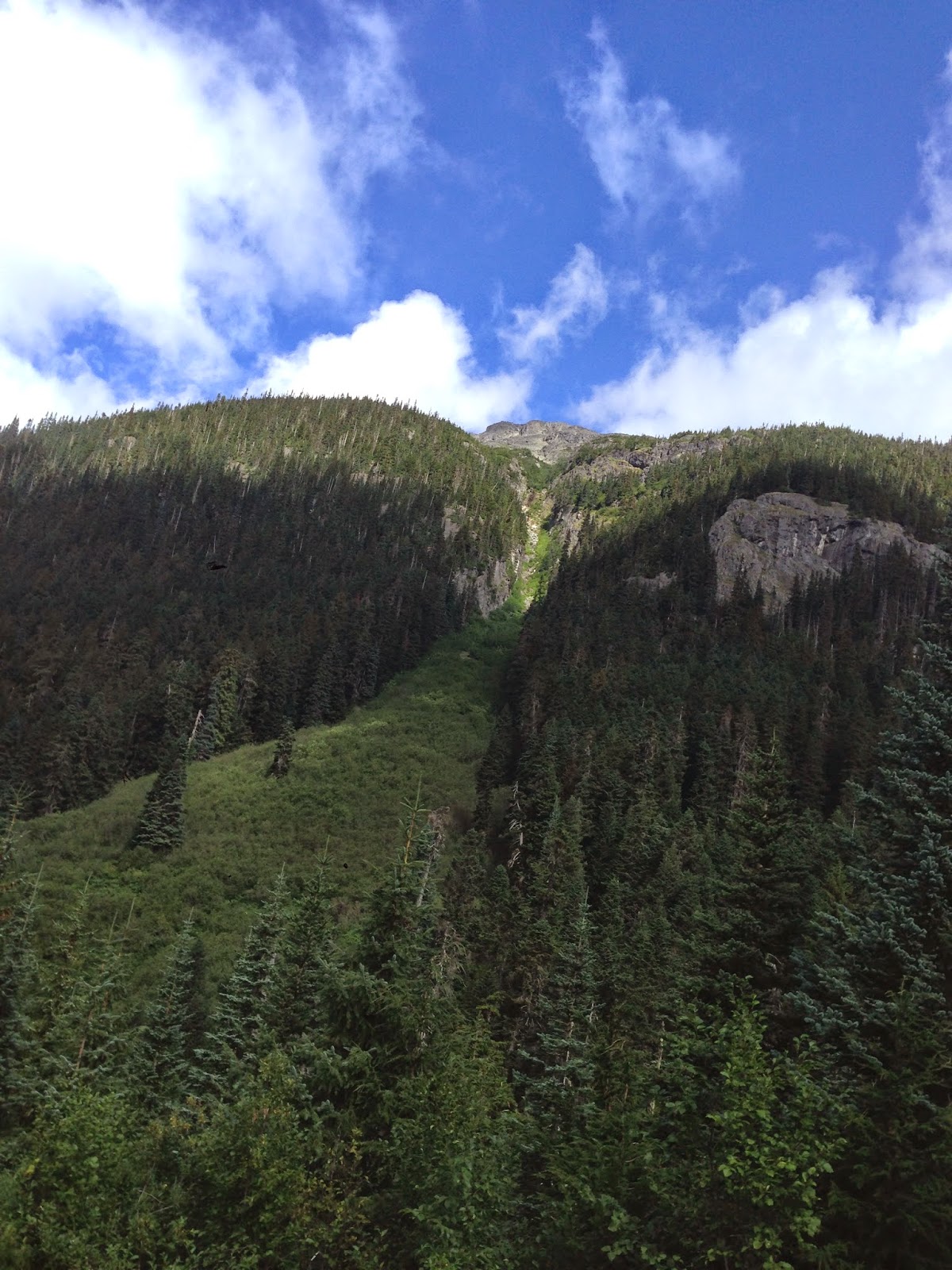
There were a a few old bridges across some creeks and more fallen trees but more importantly there were some nice sights.


Stopped at Stoney Lake to have a drink and a snack.  Excellent recreation site, looked to be three main areas and a few random trails going towards the lake.  Will have to spend some time here in the future exploring/camping.


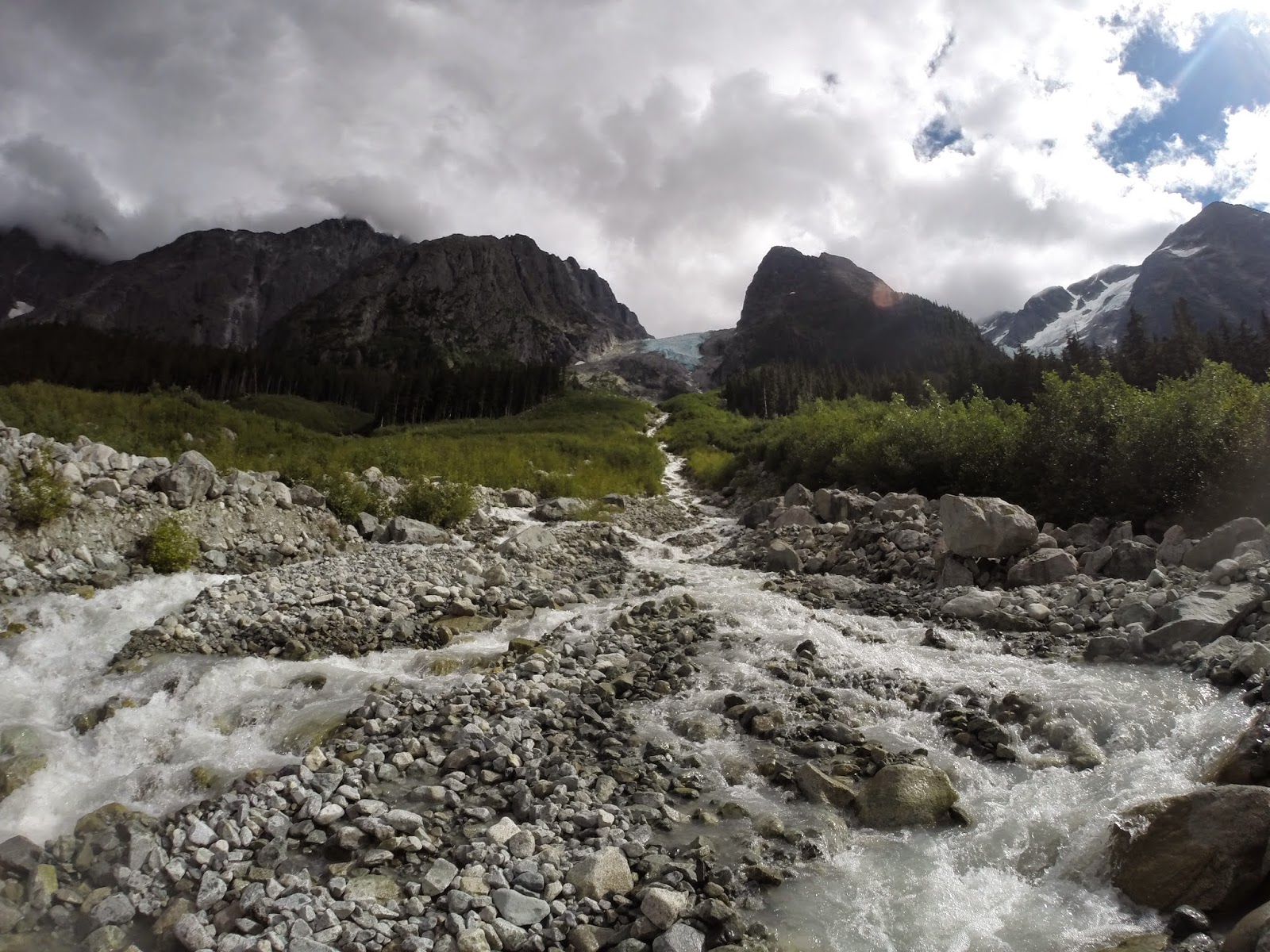
Played in many puddles along the way.  Had a scenic stop or two.


This is my kind of main street!

I stopped at a nice look out as I was getting into more mountainous territory.  Thinking i was close to my destination, found a small trail off the road and quickly noticed the sign that this was the trail that I had been searching for.  I took a video of 90% of my journey up, missing some obstacles at the bottom, I sped it up as it was a long journey as it was.  Video editing isn't my forte.  


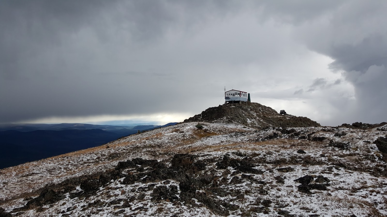
Only had to move one tree on the way up.  It began to rain, then turned to sleet as i kept climbing.  Stopped for a few pics at a scenic point where you start to drive around the backside of the mountain before making the final steep and rocky path up to the peak.  As i got to the top, snow/hail and fog!  Was fun watching the fog roll over the tops of the nearby peaks and into the valleys.
Almost the top

Looking nearly straight down!


Video of driving up. Make sure you watch in HD, its a bit long.  As usual, mounting the camera on the dash doesn't do justice on how steep it is at times.
I stuck around for an hour and ate some dinner.  Paged through the guest book in the fire tower and found my old signature in there.  Also found a geocache up there and signed that for fun too.  The snow really started coming down and I figured I should be on my way before it gets dangerous. Half tank of fuel left, I used my jerry can just in case. Shortly after leaving, I came across 3 hikers in the snow.  One was in shorts and T shirt.  They said they were fine, asked how long till the top, discussed the weather and I was on my way.  It wasn't bad heading down and once i got back into the trees the snow turned to rain.  I believe by the time i got to the bottom it was no longer raining.  I did take video down as well but I've yet to sort through it.  Heading back I backtracked to the Willow River and took a route that my GPS suggested I took to get there all day.  It was the main FSR road though and was on the East side of the river.  Was fairly easy driving.  Was maybe three hours from the bottom of the mountain to my door.  I made one stop on the bridge crossing the Willow and again to air up at the same place I aired down, Buckhorn Lake.

Sunday, 21 December 2014

Aug 15-17 Telkwa Pass

Well been a while since i've added any of my trips here.  Recently set up my screen saver to display random photos and it inspired me to add one of my favorite trips of this summer.  The Telkwa Pass lies between Telkwa (about 15 minutes outside of Smithers, BC) and Terrace.  The map shows the highway go way up and around the mountains and back down, forming a big upside down U shape to get around.  We pretty much just take a short cut straight across!
MAP
A few days before leaving there were reports of highway closure around Burns Lake due to fire, no pun intended.  There was a rather large detour around that I was able to outline on the map.  It was a pretty scenic detour for the most part, taking me down to Francois Lake and travelling along side it for what seemed like a very long time.  Francois is enormous!
Rest stop outside of Burns Lake.
 Was a beautiful tight, twisty turny road.

The road eventually turned to a gravel one and then I had to wait in a line up of vehicles for around half an hour.  I walked to the top of a little nearby hill and i could not see the front of the line!  The next hour to hour and a half back to the high way around Houston was a dusty one for having the top down!
Finally arriving in Telkwa I had planned on camping at Tyhee lake campground there.  I pulled in and saw a large black bear run across infront of me, he was too quick to disappear to get pictures. There were very few spots left there.  I set up camp and was phoned by Davy and Stan, who were looking for a camp ground as well, i invited them to come share mine and we had a few drinks around the picnic table and had a relatively early night.  There was a campfire ban in place so the rock lights and lantern lit up our night.


Morning came, we ate and hit the road for fuel and meet up with everyone in Telkwa.  Seven vehicles in total.  Was a nice meeting spot.


We hit the Telkwa River Road and began our journey.  None of us had done this trip before and we took a wrong turn or two but luckily they quickly dead ended and we were quick to right our route.  We followed the along the river and there were a few free rec sites along the way.  Next time I do this trip, I will likely stay there.


Would have liked to have explored this stream a little more.  All the red rocks seemed out of place.
We finally closed some distance on the mountains and it seemed as if there was a bit of a temperature drop.


We arrived at the trail head and there was a bit of a scare that the main trail was blocked with slash piles but there was a good way around to where the Telkwa Pass trail started.  Was a good drive in to blue lake, nothing too challenging just dirt roads, some steep hills but nothing overly challenging.


We had stopped a few times to group up along the way but our first major stop was Blue Lake.  This was a neat stop with what appeared to be a tree fort and other tables built with lumber and ply wood as well as a lovely view.  If memory serves correctly, theres a quad club out of Smithers or Telkwa that built and maintains this area. We stayed here a while and soaked the sights in.  Tight trees that were just wide enough to squeeze a jeep through.


Back out on the trail there were some steep hills but again nothing to challenging.


This beautiful lake had a little stream flowing out of it that we crossed a few times and connected to what i believe is called Top Lake.  We had lunch here and it was just an awesome place.  Couldn't take a bad picture there!


The beauty of this place was hard to describe.  Was hard to leave but the best part of the drive began here as well.  Also another group of people on quads and side by sides had pulled up and were looking to spend some time there as well.  We later learned as they passed us on the road out that they thought we'd never make it through in our vehicles.  Was fun proving them wrong!  A few of us headed across part of the lake for a little short cut, a few went around.  The next few hours were plenty of rocks, tight area's between rocks and of course driving over them with breathtaking views all along the way.  Some fun water crossings as well, through the stream of the water fall and glacial run offs.


 Some of the group missed this effigy, I ran up to snap a few pictures, was neat and seemed out of place.


I believe i got some video crossing some of these streams, sometimes the pictures don't do them justice.  We stopped numerous times to group up and enjoy the scenery.  The weather of the day was very mixed, it threatened to rain but nothing more than a light misting then the sun would reappear.  I had the top down for the whole trip i believe.  I didn't even bring my hard doors, just my soft doors which i took off for most of the trail ride.  
 The rest of the drive from around this point on out was mainly on back to dirt road, there were some large puddles and more scenery then eventually back onto the forest service road on the Terrace side.  When i do this trip again I think i'll spend a little more time exploring this road as there were a few spots that looked like they would be good to stop at.  Also I believe there was a free rec site or two on this side as well.  A woman from Terrace had read that we were doing the trip today and she met us on the road.  She showed us to a possible camp site then guided us to Fairy Island camp ground where one of our group had relatives that were the care takers there and we enjoyed a free nights stay!  We drank into the night...


The following day we drove from Terrace back to Prince George. I had planned on traveling back alone but I found it hard not to stop in Morrice town and saw a group of jeeps parked down by the bridge. I grabbed a quick couple of pics (surprise i know) and went down to join them and convoyed home with them.


The highway was open this time round but we could see the fires burning in the distance and we were stopped in burns lake when the smoke just started to roll in and darken the area.  Felt good to sleep in my own bed again that night.